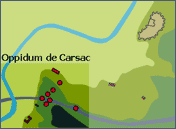
Map of the position of the Carsac oppidium and the city-state of Carcassonne.
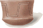
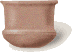
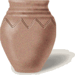
Carsac Oppidum. First Iron Age ceramics (VIIth Century BC).
ANTIQUITY
THE ORIGINS : THE CARSAC OPPIDUM
round the VIIIth Century BC, the Carsac oppidum
was established two kilometres south of the present city. The
town, which extended over more than twenty hectares on the heights
of a plateau was protected by a ditch and angled entrances.
Because of demographic growth the site was reorganised towards
the end of the VIIth Century. A second ditch reinforced by levees
and wooden palisades was made to protect the new extension.
For reasons that are not clear to us, the Carsac oppidum was
abandoned at the beginning of the VIth Century BC and moved
to the mound dominating the Aude plain. The vestiges collected
during archaeological excavations show that the site was occupied
from the early Iron Age up to the Roman conquest. They included
low drystone walls, grain silos, pottery and bronze foundry
ovens. The discovery of an abundance of goods, particularly
earthenware objects (amphoras, goblets, vases...) attests to
the activities of this settlement, open to the trading that
had been established between the Aude region and the Mediterranean
basin.
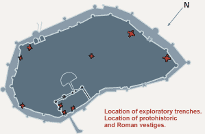
Location of archaeological excavations in the City from 1972 to 1997.
Carsac Oppidum. First Iron Age ceramics (VIIth Century BC).

 round the VIIIth Century BC, the Carsac